
 |
 |
Yorkshire |

|
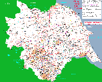
East Riding Parish Map including The Ainsty |
||
(Maps above are shown at 7% of actual size) |
||
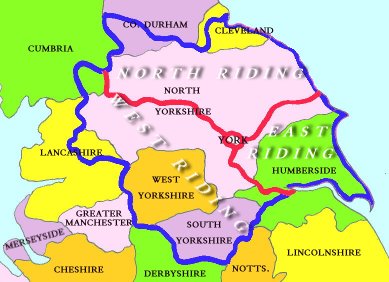
| Many people are very confused when it comes to the Ridings of Yorkshire, their boundaries, and their importance in Yorkshire family history research. Whatever part of Yorkshire you find yourself researching it is vital that you think in terms of the Ridings and not the present day post 1974 Yorkshire boundaries. While it is possible to find maps of Yorkshire in libraries and on the web, it is not always possible to find a pre 1974 map. For this reason I have produced the map below which clearly shows the old and the new county boundaries. |
 |
The present day counties are shown with a thin black boundary and black typeface. The old West, North and East Ridings are bounded by a thick blue line and divided with a red line, the Ainsty of York in the centre. Note: after Tana wrote this article, North Humberside changed its name to "The East Riding of Yorkshire" (not the same as the old East Riding). |