

Contents
|
|
|
GenUKI Contents | Yorkshire |
|
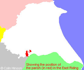
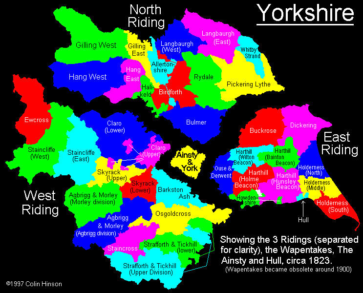
East Riding, Yorkshire |
[Transcribed information mainly from the early 1820s]
"BLACKTOFT, a parish in the wapentake and liberty of Howdenshire; 7 miles SE. of Howden, situated on the North bank of the Ouse. Opposite the village sometimes great quantities of vessels anchor, being considered a good road-stead. The steam boats from Selby and Thorne pass daily on their way to and from Hull. A bed of sand, which at low water extends over several acres, serves for the ballasting of small craft. One mile from this place, the Ouse and Trent form a junction, and from this point, (Trent Falls) the joint collection of waters are called Humber. -There is here a chapel (see Churches for photograph), not in charge, to the vicar of Brantingham. -Population 278.
A proposal was made at the latter end of the reign of Charles II. by the then Duke of Bolton, to the city of York, to get an Act of Parliament at his own charge for cutting a new river or canal from this place, on the Humber, in a direct line for York. An actual survey was taken, the charge of the ground the cut was to be made through, computed, &c. This treaty unfortunately broke off, otherwise, such a flow of tide must necessarily have come up, that we should now have had the pleasure of seeing ships of two or three hundred tons burthen lying at Ousbridge. --Drake's Ebor."
"CLEMENTHORPE, a farm house in the township and parish of Blacktoft; 3 miles NNW. of Blacktoft, 6 miles from Howden."
"GOWTHORPE, (now Gowthorpe House) a single house in the parish of Blacktoft, wapentake and liberty of Howdenshire; 3 miles N. of Blacktoft, 8 miles ESE. of Howden."
"NEWTON, farm house in the township of Scalby, and parish of Blacktoft; 3 miles N. of Blacktoft, 4 miles from Howden, 9½ from South-Cave."
"OXMARDYKE, in the parish of Blacktoft, wapentake and liberty of Howdenshire; 2½ miles NNE. of Blacktoft, 6 miles E. of Howden."
"SCALBY, in the parish of Blacktoft, wapentake and liberty of Howdenshire; 3¼ miles N. of Blacktoft, 5½ miles WSW. of South Cave. Pop. 179."