

Contents
|
|
|
GenUKI Contents | Yorkshire |
|
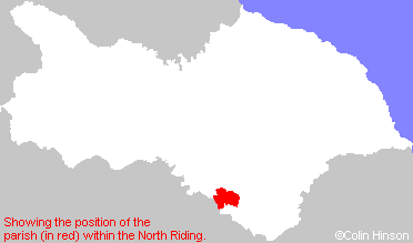
North Riding, Yorkshire |
[Transcribed information mainly from the early 1820s]
"ALNE, a parish in the wapentake of Bulmer, a part in the liberty of St. Peter's; 3½ miles SW. of Easingwold. The church is a handsome edifice, dedicated to St. Mary (see Churches for photograph), in the deanry of Bulmer. The living is a vicarage, and in the patronage of William John Bethel, Esq. of which the Rev. Henry Chaloner, A. M. is the incumbent. This village takes its name from the Latin word Alnus, (the alder tree) it being situated in a low swampy country, which formerly abounded with alders, and thence was called the Forest of Alders. Pop. 386."
"ALDWARK, in the parish of Alne, and wapentake of Bulmer, a part in the liberty of St. Peter's; 2¼ miles WSW. of Alne, 5 miles ESE. of Boroughbridge. This village is situated on the eastern bank of the Ure, which is here navigable. Pop. 163.
This place carries evident marks of antiquity in its name; and through it, by the ferry, the Roman Road from Isvrium to Eboracum passed; then went through the Forest of Galtres to Beningbrough, and entered the city of York at Bootham-Bar. -Drake."
"FLAWITH, in the parish of Alne, wapentake of Bulmer and liberty of St. Peter's ; ¾ miles W. of Alne, 5 miles E. of Boroughbridge. Pop. 94."
"THOLTHORPE, in the parish of Alne, wapentake of Bulmer, and liberty of St. Peter's; 1½ miles WNW. of Alne, 5 miles SW. of Easingwold. Population, 238."
"TOLLERTON, in the parish of Alne, wapentake of Bulmer, and liberty of St. Peter's; 1¼ miles SE. of Alne, 4 miles S. of Easingwold. This village, situated on the verge of the great forest of Galtres, is supposed to be one of the places where travellers, on entering the forest, paid a certain toll, for which they were furnished with a guide, properly armed, to defend them from the attacks of robbers and wild beasts, with both of which that extensive forest is said to have abounded. Here is a Methodist chapel and Sunday school. At the western extremity of the village runs a small rivulet, which tradition says was once a navigable river, named Carr or Kyle, and, in digging for the foundation of a water mill, in 1815, part of a ship was discovered, at the depth of from ten to twelve feet below the surface. There is here a fair for sheep and cattle on the 15th of August. Population. 481."
"YOULTON, in the parish of Alne, and wapentake of Bulmer; 1¼ miles SSW. of Alne, 5 miles SSW. of Easingwold. Pop. 56. of Easingwold. Pop. 56."