

Contents
|
|
|
GenUKI Contents | Yorkshire |
|
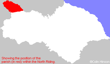
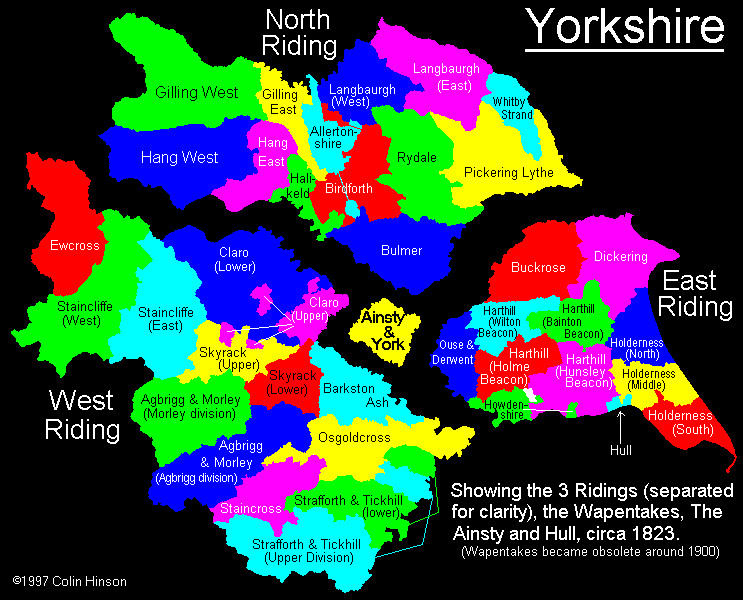
North Riding, Yorkshire |
[Transcribed information mainly from the early 1820s]
"ROMALDKIRK, a parish in the wapentake of Gilling West, and liberty of Richmondshire; 6 miles NW. of Barnard Castle. A most extensive parish, situated in Teesdale, extending from Deepdale, near Barnard Castle, to the confines of the three counties of York, Durham, and Westmoreland. This parish includes the townships of Lartington, Cotherstone, Hunderthwaite, Mickleton, Lune, Helwick, and Romaldkirk. Population, 377." (There is further information for Romaldkirk).
Information on the following places in this Parish is contained on a supplementary page.
- Arngill
- Birtle
- Bowbank
- Corn Park
- Cotherstone
- Cragg
- Crossthwaite
- Deepdale
- Doe Park Hall
- East Briscoe
- Eastfield
- Grassholme
- Greengates
- Hagworm Hall
- Holwick
- Hunderthwaite
- Hury
- Kelton
- Laithkirk
- Lartington
- Lonton
- Loupside
- Lunedale
- Mickleton
- Naby
- Nettlepot
- Scoon Bank
- Thring Garth
- Thringarth Hill
- Thwaite Hall
- Unthank
- Waybill
- Wemmergill Hall
- Westfield
- Wooden Croft
- Wythes Hill