

Contents
|
|
|
GenUKI Contents | Yorkshire |
|
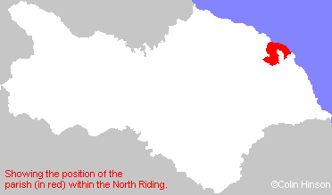
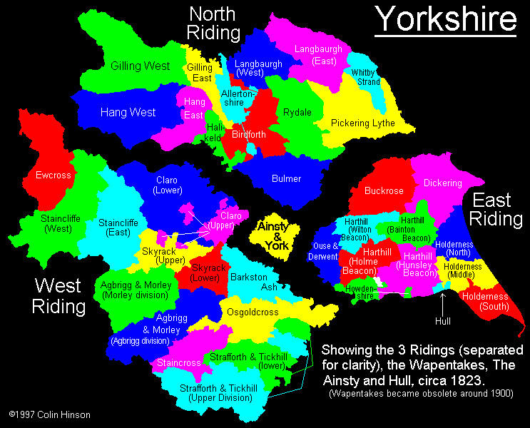
North Riding, Yorkshire |
[Transcribed information mainly from the early 1820s]
"WHITBY, a parish in the wapentake and liberty of Whitby Strand; 22 miles from Guisborough, 20 from Scarborough, 31 from Stokesley, and 47 from York; in 54 deg. 29 min. 24 sec. north latitude, and 35 mm. 59 sec. west longitude. The town stands on two opposite declivities, at the mouth of the Eske, by which river it is divided into two parts, which are connected by a draw-bridge so constructed as to admit vessels of 32 feet wide." (There is further information for Whitby).
Information on the following places in this Parish is contained on a supplementary page.
- Aislaby
- Cock Mill
- Cross Butts
- Dunsley
- East Row
- Eskdaleside
- Falling Foss
- Field House
- Hagg
- High Hawsker
- High Stakesby
- Iburndale
- Larpool Hall
- Leas Head
- Littlebeck
- Mitton Hill
- Newholm
- Newton House
- Park Gate
- Raithwaite
- Rathwaite
- Raw
- Ruswarp
- Sleights
- Sneaton Castle
- Stainsacre
- Stepney
- Stoupe Brow
- Ugglebarnby
- Woodlands