

Contents
|
|
|
GenUKI Contents | Yorkshire |
|
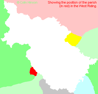
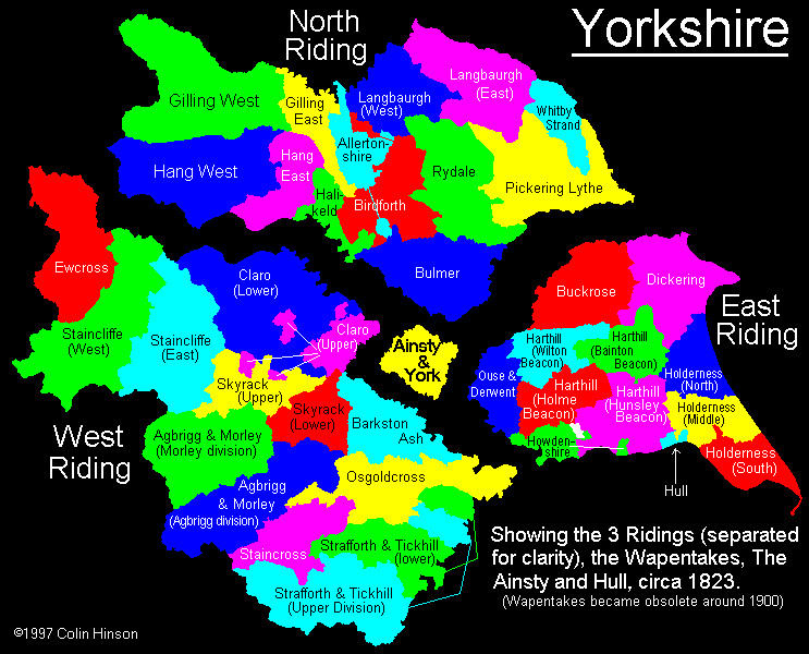
West Riding, Yorkshire |
[Transcribed information mainly from the early 1820s]
"ROCHDALE, a parish in the county of Lancashire, and additionally placed in the Genuki Yorkshire pages so as to hold the places within its boundaries which are actually in the old West Riding of Yorkshire."
Information on the following places in this Parish is contained on a supplementary page.
- Austerlands
- Bakestone Delf
- Bank Top
- Bleak Hey Nook
- Boarhurst
- Bottoms
- Brook Bottom
- Calf Hey
- Care
- Care Hill
- Castleshaw
- Causey Side
- Cherry Clough
- Clough
- Cross
- Deanshaw
- Delph
- Denshaw
- Diggle
- Dobcross
- Doctor Houses
- Dowe
- Fair Banks
- Fernlee
- Friarmere
- Goburn Clough
- Grange
- Grasscroft
- Greenfield
- Grove
- Harrop Green
- Heathfields
- Heights Chapel
- Hey Chapel
- High Moor
- Hollin Bank
- Hollins
- Holly Grove
- Husteads
- Junction
- Lane Head
- Linfitts
- Lydgate
- Mantle Yate
- New Delph
- New Houses
- New Tame
- Oak View Mill
- Old Hey
- Old Tame
- Pob Green
- Primrose
- Quick
- Roebuck Low
- Running Hill Head
- Saddleworth
- Saddleworth Church
- Saddleworth Fold
- Sandbed
- Shaw Hall
- Shaws
- Shelderslow
- Skelderslow
- Slades Barn
- Stone Breaks
- Tame Water
- Thurston Clough
- Thurstones
- Todmorden
- Top O' Th' Meadows
- Tunnel Mouth
- Tunstead
- Turf Lane
- Uppermill
- Wall Hill
- Warrock Hill
- Waterhead Mill
- Weakey
- Wellihole
- White Lee
- Wood Brook
- Wool Road
- Wright's Grove